| เราพยายามที่จะ จำกัด วงเว็บไซต์ของเราในภาษามากที่สุดเท่าที่เป็นไปได้ แต่หน้านี้ในปัจจุบันคือเครื่องแปลโดยใช้ Google แปล | ใกล้ |
-
-
ผลิตภัณฑ์
-
แหล่งที่มา
-
สนับสนุน
-
บริษัท
-
ล็อกอิน (or เข้าระบบ)
-
.an1 นามสกุลของไฟล์นามสกุล
ผู้พัฒนา: DeLormeประเภทไฟล์: Street Atlas USA Draw Fileคุณอยู่ที่นี่เพราะคุณมีไฟล์ที่มีนามสกุลไฟล์ที่ลงท้ายด้วย .an1. ไฟล์ที่มีนามสกุลไฟล์ .an1 สามารถถูกเปิดตัวโดยการใช้งานบาง เป็นไปได้ว่า .an1 ไฟล์ที่เป็นไฟล์มากกว่าข้อมูลเอกสารหรือสื่อซึ่งหมายความว่าพวกเขาไม่ได้หมายถึงการจะดูที่ทั้งหมดสิ่งที่เป็น .an1 ไฟล์
ไฟล์ที่มีนามสกุล AN1 จะเรียกว่าถนน Atlas สหรัฐอเมริกาวาดภาพและไฟล์ AN1 เหล่านี้จะถูกนำมาใช้โดยการประยุกต์ใช้ถนน Atlas สหรัฐอเมริกาเป็นข้อมูลอ้างอิงเมื่อผู้ใช้ดูไฟล์ที่ส่งออกโครงการที่เกี่ยวข้องนอกจากนี้ยังสร้างขึ้นโดยใช้โปรแกรมนี้ ไฟล์เหล่านี้ AN1 ยังสามารถสร้างและเข้าไปเกี่ยวข้องหรือเป็นไฟล์ที่ส่งออกโครงการที่มีถนน Atlas สหรัฐอเมริกาซอฟแวร์ โปรแกรมนี้จะสร้างไฟล์เหล่านี้ AN1 แต่ละครั้งที่ผู้ใช้เข้าสู่รายละเอียดกราฟิกที่เกี่ยวข้องกับไฟล์ที่ส่งออกโครงการ เมื่อไฟล์ที่ส่งออกโครงการจะดูได้โดยผู้ใช้ถนน Atlas สหรัฐอเมริกาโปรแกรมโปรแกรมนี้ตั้งอยู่ที่เกี่ยวข้อง .an1 ไฟล์และการอ้างอิงข้อมูลที่เก็บไว้ในไฟล์ AN1 เหล่านั้นเช่นเส้นทางแผนที่ป้อนโดยผู้เขียนของไฟล์ที่ส่งออกโครงการในหมู่อื่น ๆ รายละเอียดทางภูมิศาสตร์ ซอฟแวร์ถนน Atlas USA เป็นโปรแกรมนำทางจีพีเอสที่พัฒนาโดย Delorme เพื่อให้ผู้ใช้วิธีที่สะดวกในการสร้างไฟล์แผนที่ ไฟล์ที่จัดเป็นแฟ้มข้อมูลหมายถึงข้อมูลที่เก็บไว้ในไฟล์ที่จะต้องมีการอ้างอิงโหลดหรือใช้โดยโปรแกรมประยุกต์ที่เกี่ยวข้อง เรื่องนี้เกิดขึ้นเมื่อผู้ใช้ของโปรแกรมเปิดและมุมมองเนื้อหาของไฟล์ข้อมูลหรือไฟล์ที่ส่งออกที่เกี่ยวข้องที่สอดคล้องกับไฟล์ข้อมูลอื่น ๆ รูปแบบ AN1 ถูกนำมาใช้เพื่อการนี้และไฟล์ผนวกกับ .an1 ขยายจะจัดเป็นแฟ้มข้อมูลวิธีการเปิด .an1 ไฟล์
เปิดตัว .an1 แฟ้มหรือไฟล์อื่น ๆ บนเครื่องคอมพิวเตอร์ของคุณโดยดับเบิลคลิกที่มัน ถ้าความสัมพันธ์ของแฟ้มของคุณจะถูกตั้งค่าอย่างถูกต้องโปรแกรมประยุกต์ที่หมายถึงการเปิดของคุณ .an1 แฟ้มจะเปิดมัน มันเป็นไปได้ที่คุณอาจจำเป็นต้องดาวน์โหลดหรือซื้อโปรแกรมที่ถูกต้อง นอกจากนี้ยังเป็นไปได้ว่าคุณมีโปรแกรมที่ถูกต้องในเครื่องคอมพิวเตอร์ของคุณ แต่ .an1 ไฟล์ที่ยังไม่ได้ที่เกี่ยวข้องกับมัน ในกรณีนี้เมื่อคุณพยายามที่จะเปิด .an1 ไฟล์ที่คุณสามารถบอก Windows ที่แอปพลิเคที่ถูกต้องสำหรับแฟ้มที่ จากนั้นเปิด .an1 แฟ้มจะเปิดโปรแกรมที่ถูกต้อง คลิกที่นี่เพื่อแก้ไขความสัมพันธ์ของแฟ้ม .an1 ข้อผิดพลาดการใช้งานที่เปิดได้ .an1 ไฟล์
 DeLorme Street Atlas USA
DeLorme Street Atlas USA
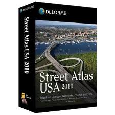
DeLorme Street Atlas USA is a mapping software developed by DeLorme for mapping, planning, traveling, routing, and GPS navigating with detailed and updated streets of U.S., Canada and highways/major roads of Mexico. It is ideal for Desktops, Laptops, iPods, GPS and PDAs with support on Pocket PCs, Windows Vista / Mobile 5.0, Ultra-Mobile PC Computer, and iPods which also include Palm OS. It is suggested to use it on planning your vacation, business trip, house-hunting trips, college visits, motorcoach and truck travel, exploring back roads of America without getting lost, planning for emergency evacuations, lodging and food, and a lot more! Its core functions are controlling maps, drawing, information, voice commands while tracking, Netlinking and aerial imagery, mobile device mapping, and maps on iPods. The software has also features which you can locate 900+ malls, access airport roads, and translucent highlight to see map data beneath the routes, convenient DVD-ROM edition where you can run it in DVD drive or load it to your hard drive, and has a truck stop data that extends service offering information.คำเตือน
ระวังไม่ให้เปลี่ยนชื่อนามสกุลใน .an1 ไฟล์หรือไฟล์อื่น ๆ ซึ่งจะไม่เปลี่ยนประเภทของไฟล์ เพียง แต่ซอฟต์แวร์แปลงพิเศษที่สามารถเปลี่ยนไฟล์จากไฟล์ประเภทหนึ่งไปยังอีกสิ่งที่เป็นนามสกุลของไฟล์หรือไม่
นามสกุลไฟล์เป็นชุดของสามหรือสี่ตัวอักษรที่ส่วนท้ายของชื่อไฟล์นั้นในกรณีนี้ .an1. นามสกุลไฟล์ที่บอกคุณว่าชนิดของไฟล์ที่เป็นของ Windows และบอกสิ่งที่โปรแกรมสามารถเปิดได้ หน้าต่างมักจะร่วมโปรแกรมเริ่มต้นที่จะขยายแต่ละไฟล์เพื่อที่ว่าเมื่อคุณดับเบิลคลิกที่ไฟล์โปรแกรมที่เปิดโดยอัตโนมัติ เมื่อโปรแกรมที่ไม่ได้อยู่บนเครื่องคอมพิวเตอร์ของคุณบางครั้งคุณสามารถได้รับข้อผิดพลาดเมื่อคุณพยายามที่จะเปิดไฟล์ที่เกี่ยวข้องแสดงความคิดเห็น

